


Victoria Public Library Voting District, Lunenburg County, Virginia
About
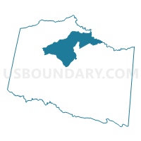
Outline

Summary
| Unique Area Identifier | 682116 |
| Name | Victoria Public Library Voting District |
| County | Lunenburg County |
| State | Virginia |
| Area (square miles) | 36.44 |
| Land Area (square miles) | 36.35 |
| Water Area (square miles) | 0.09 |
| % of Land Area | 99.74 |
| % of Water Area | 0.26 |
| Latitude of the Internal Point | 37.02059780 |
| Longtitude of the Internal Point | -78.24904050 |
Maps


Graphs
Select a template below for downloading or customizing gragh for Victoria Public Library Voting District, Lunenburg County, Virginia


Neighbors
Neighoring Voting District (by Name) Neighboring Voting District on the Map
- Brown's Store Voting District, Lunenburg County, VA
- Hounds Creek Voting District, Lunenburg County, VA
- Meherrin Fire Dept Voting District, Lunenburg County, VA
- Peoples Community Center Voting District, Lunenburg County, VA
- Pleasant Grove Voting District, Lunenburg County, VA
- Plymouth Voting District, Lunenburg County, VA
- Precinct 1-2, Nottoway County, VA
- Reedy Creek Voting District, Lunenburg County, VA
Top 10 Neighboring County Subdivision (by Population) Neighboring County Subdivision on the Map
- Meherrin River district, Lunenburg County, VA (3,490)
- District 1, Nottoway County, VA (3,210)
- Hounds Creek district, Lunenburg County, VA (1,889)
- Rehoboth district, Lunenburg County, VA (1,817)
- Loves Mill district, Lunenburg County, VA (1,496)
- Browns Store district, Lunenburg County, VA (1,310)
- Plymouth district, Lunenburg County, VA (1,072)
Top 10 Neighboring Place (by Population) Neighboring Place on the Map
Top 10 Neighboring Unified School District (by Population) Neighboring Unified School District on the Map
Top 10 Neighboring State Legislative District Lower Chamber (by Population) Neighboring State Legislative District Lower Chamber on the Map
Top 10 Neighboring State Legislative District Upper Chamber (by Population) Neighboring State Legislative District Upper Chamber on the Map
Top 10 Neighboring 111th Congressional District (by Population) Neighboring 111th Congressional District on the Map
Top 10 Neighboring Census Tract (by Population) Neighboring Census Tract on the Map
- Census Tract 3, Nottoway County, VA (7,064)
- Census Tract 9301, Lunenburg County, VA (5,877)
- Census Tract 9302, Lunenburg County, VA (4,583)
- Census Tract 2, Nottoway County, VA (2,719)
Top 10 Neighboring 5-Digit ZIP Code Tabulation Area (by Population) Neighboring 5-Digit ZIP Code Tabulation Area on the Map
- 23930, VA (5,690)
- 23974, VA (5,012)
- 23947, VA (4,293)
- 23954, VA (2,017)
- 23942, VA (1,112)
- 23952, VA (217)